Current Exhibitions
Oblique Views: Archaeology, Photography, and Time
Oct 25, 2015 — May 7, 2017
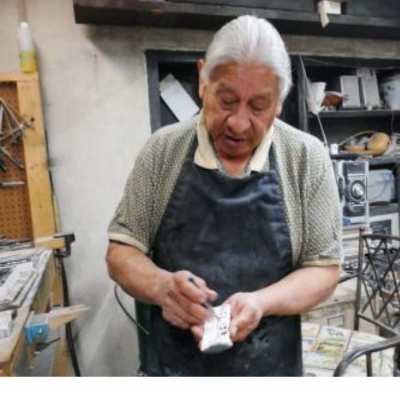
For the first time in Oblique Views: Archaeology, Photography, and Time, large prints of Heisey’s stunning images will be paired directly with the Lindberghs’. The exhibition opens October 25, 2015 and runs through May 7, 2017 at the Museum of Indian Arts and Culture.
During 2007 and 2008, flying at alarmingly low altitudes and slow speeds, Adriel Heisey leaned out the door of his light plane, and holding his camera with both hands, re-photographed some of the Southwest’s most significant archaeological sites that Charles Lindbergh and his new bride Anne photographed in 1929.
Santa Fe
While still not large, Santa Fe has grown remarkably since 1929. Houses cover the areas that were once farmed, and flat roofs around the Plaza dominate the scene. The Palace of the Governors (now backed by the New Mexico History Museum), the New Mexico Museum of Art, the cathedral, and other beloved buildings are still in use. The Roundhouse has replaced the old capitol building, which was remodeled and converted to administrative use. The river still flows through Santa Fe, at least seasonally, but it is less visible among the sea of buildings that engulf it. A few solar panels show environmental investment by individuals. Photograph by Adriel Heisey, 2015.
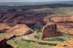
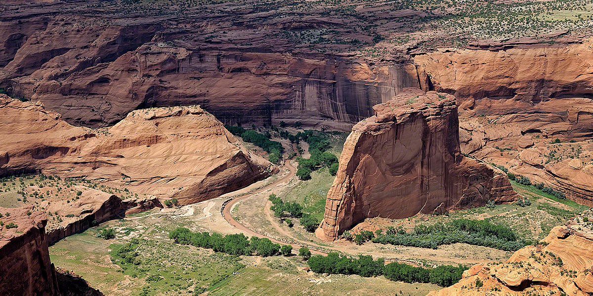
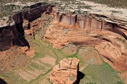
White House
White House is harder to see now because of the additional vegetation. This is the only site in Canyon de Chelly that is accessible without a guide and is by far the most visited ruin in the canyon. A hiking trail leads to the site from a parking lot on the rim above. A pedestrian bridge over the wash can be seen, as can the hiking trail. Tour trucks and jeeps park at the ruin-end of the bridge, although they ford the wash rather than crossing the bridge. Even outside the wash, plant growth is lusher today, in part because the site is not being grazed as intensively as it was in 1929. Photograph by Adriel Heisey, 2008.
Standing Rock
Standing Rock in Canyon del Muerto. This scene is much like that in 1929, except that the stream has changed its course and the field is now planted in a more standard linear layout. The field is smaller than in 1929 because a small slump of debris from the canyon wall to the left extends farther than it used to. Perhaps in response, additional fields have been planted. Photograph by Adriel Heisey, 2008.
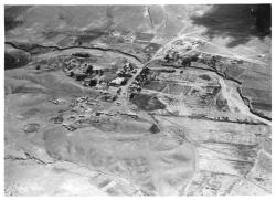
Galisteo
The village of Galisteo, south of Santa Fe, was established sometime between 1790 and 1816. Prior to the Pueblo Revolt of 1680, perhaps as many as fifteen thousand people lived in a number of very large pueblos in the Galisteo Basin. When the Spanish returned in 1692, the Pueblo Indians left basin communities and joined other pueblos, mostly along the Rio Grande. Sustained colonial use of the basin, beyond the early missions at the pueblos, started in the late 1700s with livestock grazing and the establishment of a military outpost. By 1929 Galisteo Creek was being used to irrigate farmed fields, some of which were laid out in the Spanish fashion in long narrow strips. Two fenced cemeteries can be seen to the left, and the road encircles the church in the center of the photograph—a building that was probably also the center of the village. Photograph by Charles A. and Anne Morrow Lindbergh, 1929.